
Dartmouth Past Resident Records by Era
The record trail behind a Dartmouth address changes with the period. Begin with the modern parcel card and current deed when the property is recent. For an older address, add directory, census, map, and local-history evidence. The Southern District Registry's old indices are especially deep, but they are image-browse tools rather than one uniform database. A source can date a transfer, show a household, or describe a structure. It rarely does all three.
| Source | Years it covers | Where held | What it shows |
|---|---|---|---|
| Southern Registry old index | 1690-1837; 1837-1885; 1886-1902; 1903-1917; 1918-1932; 1933-1957; later grantor/grantee blocks through 1977 | Registry website and office | Grantor/grantee paths and index images; range varies by name and role |
| DHAS Bristol deed abstracts | Volumes 1-5 for 1687-1709; project about 1668-1767 | DHAS digital library | Early transaction abstracts and references for deeper research |
| Regional directory runs | 1905; 1909-1910; 1915; 1927; 1929-1930; 1932; selected later holdings | NARA, State Library, library request channels | Resident, street, and business entries in combined Dartmouth/Acushnet/Westport volumes |
| Town Reports and Chronicle | Town Reports from the 1890s; Chronicle from the 1960s | Dartmouth Public Library | Local names, notices, civic context, and obituaries |
| Sanborn maps | November 1924, August 1932, 1959 | Library of Congress and State Library | Structures, materials, use, and street context in mapped areas |
Use the source closest to the date first. A modern sale reference can open the deed chain. A directory or census can identify a household during a gap between transfers. A map or permit can help explain when a building or use appears, but it cannot establish a complete occupancy history alone.
Dartmouth Past Resident Parcel Starting Point
Freeze the modern parcel before moving backward. Dartmouth Vision property records support address, owner, map/lot/block or identifier, and street-list searches after entering the database. Dartmouth MapGeo adds address, identifier, owner, and spatial searching. Copy the site address, owner of record, co-owner where shown, parcel ID, legal description, book/page or certificate reference, sale reference, and both site and mailing addresses.
These fields serve different purposes. The situs address is the physical parcel. The owner mailing address is where a tax bill is sent and can point outside Dartmouth or to a trust, entity, or service address. A parcel owner is not proof of who occupied the address. The legal description, lot, plan, and parcel ID are usually more durable search keys when an early deed uses bounds, a farm, a mill, or a neighbor instead of a modern road number.
MapGeo and Vision records are a practical first step, but each card has an as-of date and the Town warns map data may not be current. Preserve the date of the card with the values copied from it.
Dartmouth Past Residents in Old Deed Indices
The Bristol South old grantor and grantee indices give the Dartmouth address trail unusual depth. The recorded browse blocks run from 1690-1837, then through periods ending 1885, 1902, 1917, 1932, and 1957, with later grantor and grantee coverage varying into the 1970s. They are images arranged for index research, so a researcher needs the party name, the correct role, and a likely alphabet block before finding the deed reference.
Search both roles and use spelling variants. The Registry warns that spacing, prefixes, compound names, and spelling differences can hide a result. Its current record-search instructions also warn that online encumbrance lists are reference tools and may omit a back-indexed document visible on the book encumbrance sheet. When the online path ends, use old-index images, Registry terminals, office assistance, or an official copy request.
Note: Record the book, page, certificate, plan, and party role at every step, since a street number may never appear in an early land record.
Dartmouth Deed Chain for Past Residents
A chain of title follows ownership transfers backward. The current buyer is normally the grantee on the purchase deed, while the seller is the grantor. The next step is counterintuitive but important: search that seller as a grantee to find the earlier acquisition. Read every instrument for a prior book/page, certificate, plan, lot, or legal description reference before starting the next search.
- Open the current Vision or MapGeo parcel card and copy the owner, legal parcel details, and book/page or sale reference.
- Use the Southern District Registry record search to find the current owner's purchase instrument as grantee.
- Read the deed, identify its grantor, and capture the prior-reference and legal-description language.
- Search that grantor as grantee for the earlier purchase, then repeat the same reading process.
- When the current system does not reach the period, shift to the old index images, office terminal, microfilm, or Registry copy channel.
- Grantor
- The party transferring an interest in a deed.
- Grantee
- The party receiving that interest in a deed.
- Chain of title
- The documented sequence of transfers used to connect one ownership event with an earlier one.
- Legal description
- The lot, plan, bounds, or other land description that identifies the parcel more reliably than an old address label.
Inheritance can interrupt a simple deed chain. When a transfer seems to disappear, search probate under the last known owner and related family names. Bristol Probate and Family Court in Taunton holds estate files that can identify a decedent, petitioner, personal representative, heirs, attorneys, addresses, and case events, subject to restrictions.
Dartmouth Past Residents and Map Dates
Sanborn maps can date a structure or land use when a deed only describes land. The State Library listing identifies Dartmouth editions from November 1924, August 1932, and 1959, and the Library of Congress Dartmouth Sanborn item provides a digitized map-collection entry. Read the sheet title, date, block, building material, use, and street context. Coverage is strongest in mapped places and is not proof for every rural parcel.
A map showing a building in 1932 is evidence to pursue, not proof of its exact construction date or every household within it. Combine the map date with a deed, a directory entry, a Town Report, or a permit record. Dartmouth public materials indicate a keyword or property-address path for permit material, but the official text did not establish an earliest online permit year. Ask the Building Department Records Access Officer for an existing index or file when the portal does not go far enough back.
Dartmouth Past Residents and Place Names
Dartmouth has no verified townwide street-renumbering year in the research record. Do not invent one to explain an address mismatch. The practical issue is older vocabulary: Hixville, Bliss Corner, Padanaram, Smith Mills, and Russells Mills can appear in local history, directories, deeds, and maps. Older instruments may instead name a neck, farm, mill, proprietor division, or neighboring owner.
Use the 1856 Town map, Dartmouth Historical and Arts Society historic maps, tax maps, plans, and modern parcel geometry as a crosswalk. A name that seems to vanish may have moved into a different village label or been indexed under a neighboring town in a combined volume. Keep the original wording in notes, then record the modern parcel match separately rather than silently replacing one with the other.
Dartmouth Past Households in Directories and Census
Ownership is only part of an historical-address search. Regional Dartmouth/Acushnet/Westport directories can place names along a street or within a village, while the census adds household relationships, ages, birthplaces, and other period context. Pair each directory year with the closest census rather than trying to project a later owner back to an earlier household. The directory collections themselves are described in the Dartmouth City Directory.
- Choose the nearest verified directory year and record its exact regional title and place label.
- Search the alphabetic section for the surname, then inspect a street or house-guide section when present.
- Compare the entry with the closest public federal census, including the 1950 release and the library's HeritageQuest coverage description.
- Use Town Reports or Chronicle microfilm to test a move, death, marriage, notice, or civic appearance between the dated records.
- Close the household trail with probate, a vital-record channel, cemetery information, or a deed only when the source fits the question.
A missing name can mean a move, death, marriage or name change, a directory gap, an unlisted household, or a regional indexing choice. It is a reason to compare sources, not a conclusion by itself.
Dartmouth Past Residents Before Modern Deeds
Dartmouth's early land record story reaches beyond a present-day parcel card. The DHAS land-record research guide describes Bristol County abstracts in volumes 1-5 for 1687-1709 and a broader local transcription project that reaches about 1668-1767. It also explains when an old title trail may require probate and genealogy because land remained in a family before a later recorded transfer.
DHAS links its early work to a 1652 deed lead and directs researchers toward probate and old tax-record leads where the land chain becomes incomplete. A historic transcription is a navigational tool. Use its volume, page, film, or image reference to locate the underlying Registry, probate, map, or archival record when confirmation matters.
The DHAS land-record guide explains the local bridge between early abstracts and the official deed trail.
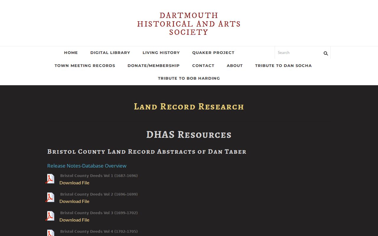
The guide helps turn an early land reference into a documented next search, particularly where modern address language does not exist.
Dartmouth Past Resident Trail Endpoints
Obituaries, cemetery information, and probate often explain why a household trail stops. Dartmouth Public Library's Chronicle microfilm begins in the 1960s, while local history, DHAS burial materials, and cemetery contacts add nearby search paths. No official online interment index was located for Dartmouth's town cemeteries. Contact the Cemetery Division, Town Clerk, DHAS, or library rather than treating an empty web search as proof of no burial.
Current vital records are not a browsable online index. Dartmouth Town Clerk holds local birth, death, and marriage records, and Massachusetts RVRS issues certified statewide copies generally from 1936 forward. Access changes by record type and date. Birth and marriage records generally become genealogically open after 90 years, and death records after 50 years, with restricted categories and identity or relationship requirements for some current copies.
Lawful use. Dartmouth previous-resident research belongs to family history, house history, estate questions, and personal curiosity. Verify important facts with the custodian and never use records to stalk, harass, or harm anyone.
Note: A name on a deed, directory, cemetery record, or obituary answers a different question, so label each finding by its source and date.